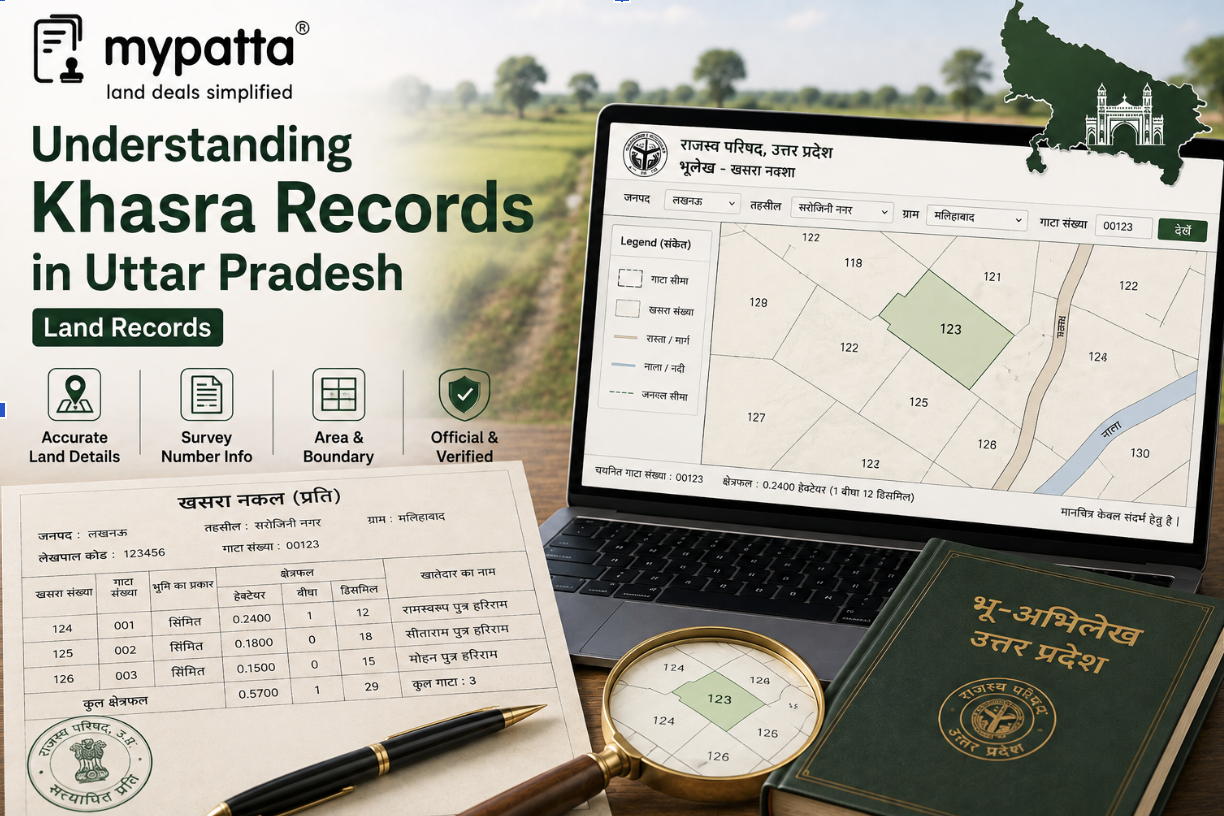
How to download Khasra Land Records in Uttar Pradesh
You can get the Khasra Land Records in Uttar Pradesh online easily via mypatta without visiting the Sub-Registrar office.
- Open mypatta and log in or sign up if needed.
- Go to property documents, ensure “Uttar Pradesh” is selected as the state, then tap the “Khasra Land Records” icon.
- Enter required information.
- Tap “Search”
- Once the Khasra Land Records is available to download, tap “View Document”. You can now save or share or download this document in PDF on your device.
How to Match the Khasra With the Registered Property Description
The Khasra and registered property document should identify the same agricultural parcel, even though they record different information.
A registered sale, gift, partition or release deed explains the transaction through which rights were transferred. The Khasra is a plot-wise field record maintained for the revenue village. Under Section 30 of the Uttar Pradesh Revenue Code, the Collector must maintain a village map and field book, or Khasra, and record changes affecting village boundaries or survey numbers.
The comparison should cover the following details:
| Detail | Registered property document | Khasra and connected revenue record |
|---|
| Location | District, tehsil, village and property schedule | District, tehsil, village and village code |
| Parcel identity | Gata, Khasra or plot number | Current Gata or Khasra number |
| Area | Area stated to be transferred | Total recorded area of the field parcel |
| Seller’s interest | Entire parcel, fractional share or specified portion | Must be checked with the seller’s share in the Khatauni |
| Land description | Boundaries, adjoining properties and access | Plot classification, field particulars and map connection |
| Transaction date | Execution and registration dates | Relevant Fasli year and later mutation position |
Confirm the complete location
The same Gata number may exist in different villages. The Khasra should therefore be matched using the complete combination of:
- district;
- tehsil;
- village;
- village code, where available;
- Gata or Khasra number; and
- relevant Fasli year.
A record from the correct district but a neighbouring village cannot be relied upon merely because the plot number matches.
Check whether the deed covers the whole Gata
The deed may transfer:
- the entire Gata;
- a fractional undivided share;
- a separately numbered subdivision;
- a portion described through boundaries; or
- several Gatas together.
The Khasra generally records the total field parcel. It may not separately identify the seller’s share. That share must be checked in the Khatauni and the underlying title and mutation records.
For example, a Khasra may show Gata No. 220 measuring two hectares. If the seller owns only one-fourth of the joint holding, the full two hectares should not be treated as the seller’s exclusive property.
Check old, new and minjumla numbers
The deed may contain an older Gata number while the current Khasra uses a number created after consolidation, subdivision or correction.
A minjumla entry usually indicates that the number relates to part of a larger parcel or that the parcel requires further division in the revenue records. Section 30 specifically requires physical division of minjumla numbers and corresponding correction of the map and Khasra.
Where the deed refers only to a privately identified portion of a larger Gata, the buyer should verify whether that division has been formally incorporated into the revenue map and field record.
How to Compare Khasra Details With the Revenue Map
The Khasra identifies the field through textual details, while the revenue map or Shajra shows where the Gata lies within the village.
The Uttar Pradesh Revenue Code treats the map and Khasra as connected village records. Changes in survey numbers and detected errors must be incorporated into both, while map corrections require the competent Revenue authority’s order.
The comparison should begin by locating the correct Gata on the official revenue map and checking:
- parcel shape;
- adjoining Gata numbers;
- road or pathway access;
- nala, drain, pond or watercourse;
- Gram Sabha or government land nearby;
- village boundary;
- subdivision lines; and
- any public feature touching or crossing the parcel.
Match adjoining plots
The four-boundary description in the deed should broadly correspond with the adjoining Gata numbers and permanent features visible on the map.
Names of adjoining owners may have changed because of later sales or inheritance. The plot numbers and permanent geographical features are usually more useful than an old neighbour’s name.
Do not measure from the screen image alone
A digital revenue map can help locate the parcel, but enlarging it on a screen does not make it an exact ground survey.
The official UP Bhunaksha portal cautions that minor errors may remain in georeferenced maps because of the technical limits involved in combining cadastral maps with satellite imagery. It also states that where a mapped plot area differs from the corresponding Record of Rights area, the Khatauni area is treated as authoritative for that comparison.
This does not mean the Khatauni alone settles every boundary dispute. It means the map display, Khasra, Khatauni and official measurement must be considered according to the issue being examined.
Check whether access is actually recorded
A pathway visible beside a Gata may be:
- a public village road;
- a cart track;
- a private pathway;
- a common access;
- part of another person’s land; or
- a feature that has changed physically.
The map’s appearance does not by itself create a legal easement or private right of way. Access must also be checked through title documents, map particulars, physical inspection and any relevant easement or Revenue Court record.
The Board of Revenue currently provides separate services for viewing the revenue-village map and checking the recorded boundary description of a Gata, demonstrating that map and boundary information must be examined in addition to the Khasra.
What Land-Use and Cultivation Entries Should a Buyer Examine?
A Khasra should be reviewed for the correct Fasli year because cultivation and field-use entries may change over time.
The buyer should examine whether the plot is recorded as:
- cultivated agricultural land;
- fallow land;
- uncultivated land;
- orchard or plantation;
- water-related land;
- pathway or public-use land;
- abadi or built-up use;
- government or Gram Sabha land; or
- another recognised revenue category.
The precise entry and abbreviation should be understood from the official record rather than translated casually.
Cultivation and crop details
Where available, check:
- crop recorded during the relevant season;
- whether the field was cultivated or fallow;
- person shown in cultivation;
- irrigation-related particulars;
- repeated crop pattern across earlier years; and
- any unusual remarks.
A crop entry does not prove ownership. A tenant, family member, sharecropper, co-tenure holder or unauthorised occupant may cultivate land belonging to another recorded holder.
However, repeated cultivation by someone other than the seller can be a significant due-diligence issue. The arrangement should be investigated through tenancy records, agreements, Khasra history and physical enquiries.
Compare historical and current entries
One Khasra year provides only a snapshot. Earlier records may reveal:
- long-standing cultivation by another person;
- a change from agricultural to built-up use;
- earlier classification as a pond, pathway or public land;
- changes in recorded area;
- subdivision or renumbering; or
- a recently altered possession entry.
The Uttar Pradesh e-Abhilekh system maintains digitised historical record categories, including Khasra records for several earlier Fasli years and consolidation documents where available.
Check land-use conversion separately
Physical construction or commercial activity on the land does not automatically mean that its legal revenue use has changed.
The Board of Revenue provides a separate process under Section 80 of the Uttar Pradesh Revenue Code for declaration or change from agricultural to non-agricultural use. A buyer should therefore obtain the applicable Section 80 order rather than treating a changed physical condition or recent field entry as sufficient proof of lawful conversion.
What Should Be Checked When Physical Possession Differs From the Khasra?
A difference between the Khasra and physical possession should be investigated before purchase, fencing, construction or finance.
Common discrepancies include:
- the seller possesses less land than the recorded area;
- a neighbouring owner cultivates part of the Gata;
- the boundary wall extends into another plot;
- the seller points to land that falls under a different Gata;
- a pathway or public feature occupies part of the field;
- the Khasra shows cultivation by another person;
- the claimed subdivision is not visible in the map; or
- one co-holder occupies a specific portion without formal partition.
Verify the seller’s actual possession
A site inspection should confirm:
- who is cultivating the land;
- whether the seller has exclusive or joint possession;
- whether any tenant or licensee is present;
- where the boundary marks or bunds lie;
- whether adjoining owners accept the claimed boundary; and
- whether the available area corresponds broadly with the documents.
Local statements can assist, but they should not replace official records and measurement.
Examine the cause of the difference
The discrepancy may arise from:
- unrecorded tenancy;
- family arrangement;
- informal partition;
- encroachment;
- missing boundary marks;
- wrong Gata identification;
- acquisition for a road or public project;
- changed river or nala position;
- incomplete consolidation update; or
- clerical error in the Khasra or map.
Where the Khasra contains an error or omission, Section 38 permits an application for correction to the Tahsildar. Map corrections are referred to the Collector, while other corrections are referred to the Sub-Divisional Officer. The correction process cannot be used to decide a substantive title dispute.
Do not treat cultivation as final title
The person physically cultivating the field may not be its legal owner. Equally, the person named in the Khatauni may not have actual possession.
Ownership, revenue entry and physical possession are related but distinct questions. Each must be supported separately.
Can Khasra Establish Exact Boundaries or Legal Title?
Khasra cannot, by itself, conclusively establish exact physical boundaries or legal title.
It can support parcel identification by showing the Gata number, recorded area, classification and field particulars for the relevant year. It may also help demonstrate how the land was recorded or cultivated during that period.
However, standing alone, it cannot finally prove:
- that the seller has a complete title;
- that every co-owner or legal heir has joined the transaction;
- the exact location of every boundary point;
- that the area recorded is physically available;
- that boundary stones are correctly placed;
- that no encroachment exists;
- that possession is undisputed;
- that a private division is officially recognised; or
- that the land is free from litigation or registered encumbrances.
Section 24 of the Uttar Pradesh Revenue Code provides for boundary disputes to be decided by the Sub-Divisional Officer through a summary inquiry, primarily on the basis of the existing survey map or the applicable consolidation map. Where that is not possible, the provision permits consideration of actual possession.
The existence of this separate boundary process shows why a Khasra entry alone cannot settle every ground-level dispute.
Legal ownership must be examined through:
- registered title deeds;
- earlier title chain;
- succession or partition documents;
- mutation orders;
- Khatauni;
- court or Revenue orders; and
- later transactions affecting the property.
Khasra is strongest when all these records, the revenue map and physical field identify the same parcel consistently.
When Are an Official Measurement and Additional Survey Records Required?
Official measurement or demarcation should be considered where the parcel cannot be confidently identified or the records do not match the ground.
It is particularly important where:
- part of a larger Gata is being sold;
- the record contains a minjumla number;
- no formal partition or subdivision is available;
- the deed area differs from the Khasra;
- Khasra and map show different parcel particulars;
- boundary marks are missing;
- an adjoining owner disputes the line;
- an encroachment is suspected;
- road access is uncertain;
- the seller possesses less land than recorded; or
- construction is planned close to the boundary.
The Board of Revenue provides a dedicated demarcation service under Section 24, including facilities to submit an application, check its status and view the resulting order.
Additional records that may be required include:
- certified or current Khatauni;
- latest and historical Khasras;
- revenue map or Shajra;
- Gata boundary details;
- registered deed and earlier link deeds;
- mutation and succession orders;
- consolidation map and CH forms;
- minjumla division records;
- Section 80 land-use order;
- acquisition or road-widening records;
- Revenue Court orders; and
- official demarcation report.
An official survey should establish the parcel with reference to recognised map and revenue records rather than only the seller’s visible occupation.
The strongest boundary verification exists when the deed schedule, Khasra, Khatauni, map, demarcation record and physical site all identify the same land without unexplained differences.
Why mypatta?
- Trusted by 7 Lakh+ Customers
- 1 Crore+ Documents Delivered
- mypatta Guarantee: Guaranteed delivery or a 100% refund
- 4.8-Star App Rating
Your money is safe with us: Guaranteed delivery or a 100% amount refund.
Frequently Asked Questions
- 1. Can a UP Khasra be used to confirm the boundary of agricultural land?+
It can support boundary verification by identifying the Gata, area and field particulars. Exact ground boundaries should be confirmed through the revenue map, boundary records and official demarcation where required.
- 2. What should be done if the deed area and Khasra area are different?+
The Khatauni, mutation order, map, consolidation records, subdivision history and physical measurement should be checked. The difference should be officially explained or corrected before purchase.
- 3. Does the person shown cultivating the land in Khasra become its owner?+
No. Cultivation or possession-related entries do not by themselves create ownership. The person’s legal rights must be checked through the title, tenancy, succession and revenue records.
- 4. Can a digital revenue map be used to calculate the exact land area?+
It is useful for locating and comparing the parcel, but screen-based measurement should not replace official survey or demarcation. Digital maps may also contain minor georeferencing differences.
Shivangi
Real Estate Content Writer
Shivangi is a real estate content writer with 3+ years of experience helping readers understand property documentation, land records, and legal requirements through clear and actionable content.