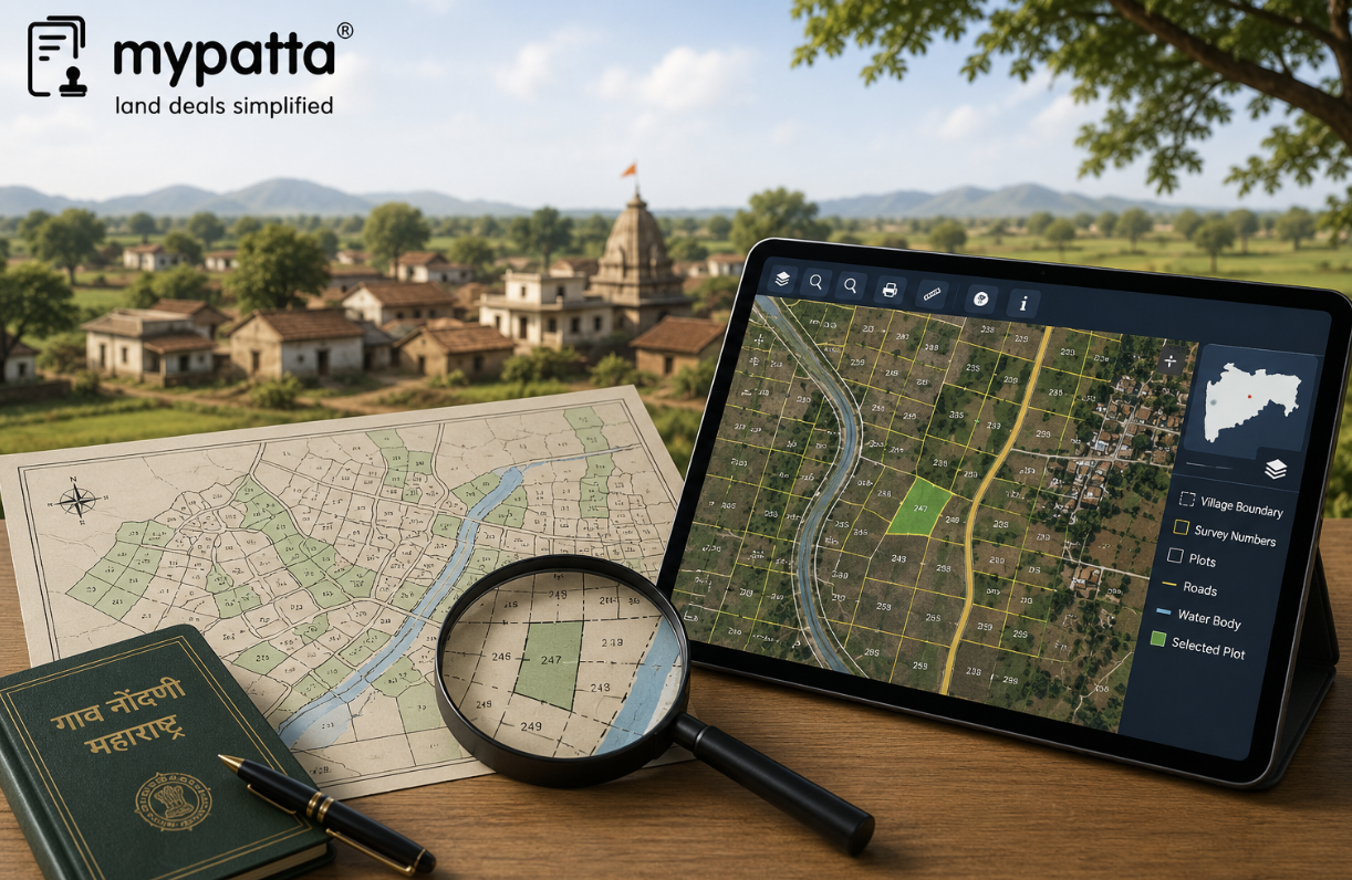
How to Download Village Map in Maharashtra
You can get the Village Map in Maharashtra online easily via mypatta without visiting the Sub-Registrar office.
- Open mypatta and log in or sign up if needed.
- Go to property documents, ensure “Maharashtra” is selected as the state, then tap the “Village Map” icon.
- Enter required information.
- Tap “Search”
- Once the Village Map is available to download, tap “View Document”. You can now save or share or download this document in PDF on your device
- Download for Android
- Download for iPhone
- Download from website - Village Map
What Is a Village Map in Maharashtra?
A village map is a cadastral survey map prepared for an entire revenue village. It divides the village into individually numbered survey parcels and shows their position in relation to neighbouring parcels, roads, streams, forests and other recognised features.
The Maharashtra Land Records Department explains that village maps were prepared as part of the survey and settlement process to show survey numbers, boundary marks and topographical details. These maps formed the basis for maintaining land-revenue records and identifying the location of individual holdings within the village.
A village map is broader than a single-plot map. A plot report may focus on one selected survey or Gat number, while the village map places that parcel within the complete cadastral arrangement of the village.
It can therefore help answer questions such as:
- Where is a particular survey or Gat number located?
- Which parcels adjoin it?
- Is a road, nala or forest area shown nearby?
- Does the land lie near the village boundary?
- Has a large survey number been divided into smaller portions?
- Does the deed’s description broadly correspond with the village layout?
The map is primarily a survey and identification record. It does not independently show a complete title chain or prove that the person occupying a parcel is its lawful owner.
Maharashtra’s Mahabhumi platform recognises village maps and land-parcel maps as a separate category of land-record data, alongside rural land records, urban Property Cards and measurement records.
What Information Is Shown on a Village Map?
The precise information depends on the period, survey method, village category and level of digitisation. An older village map may differ visually from a recent digital cadastral map, but both are intended to represent the arrangement of land within the village.
A Maharashtra village map may show:
- revenue-village boundary;
- survey numbers or Gat numbers;
- parcel and subdivision outlines;
- boundary marks;
- village settlement or gaothan area;
- roads, cart tracks and pathways;
- rivers, streams, nalas and drains;
- tanks, wells or other water features;
- forest or grazing areas;
- government or common land;
- adjoining village boundaries; and
- other topographical or public features recorded during the survey.
The Land Records Department states that traditional village maps generally show survey numbers, boundary marks and topographical details such as roads, nalas and forests. Certain Inam-village maps prepared through minor triangulation also show Hissa divisions and triangulation stones used for reconstructing boundaries.
Not every village map will display the current owner’s name. Ownership and landholder details are ordinarily examined through the 7/12 extract, 8A, mutation records or Property Card, while the map primarily helps identify the parcel spatially.
The map may also fail to show a recently created subdivision if the corresponding measurement and map update have not been completed. A land parcel shown as one unit on an old map may therefore appear as several Hissa numbers in the latest revenue records.
How Are Survey Numbers, Gat Numbers, Roads and Natural Features Identified?
Village maps use parcel numbers, boundary lines and map symbols to distinguish private holdings from public and natural features.
Survey numbers
A survey number identifies a parcel or block of land created during the original survey and settlement process. It is ordinarily written within or beside the parcel outline.
Where the survey number has been divided, separate Hissa or subdivision numbers may appear in the connected survey records. Some older village maps may show only the parent survey number, especially where the subdivision was created later.
Gat numbers
Gat numbers are commonly found in villages where holdings were reorganised through consolidation. A Gat number may combine, replace or rearrange earlier survey parcels.
Where an old registered deed refers to a survey number but the current 7/12 and village map use a Gat number, an official consolidation or correlation record should be checked. The similarity of extent or location alone should not be used to assume that the numbers refer to the same property.
Roads and pathways
Public roads, village roads, cart tracks and pathways may be shown through lines of different widths or styles. The exact appearance depends on the map’s age and legend.
A line shown on the map should not automatically be treated as a legally enforceable private access. The nature of the road or pathway should be checked through the deed, village records, acquisition documents and physical inspection.
Rivers, nalas and other natural features
Streams, rivers, nalas, tanks, forest areas and similar features may be represented through conventional symbols, labels or boundary patterns.
These features are important because they may:
- form one side of the parcel boundary;
- affect physical access;
- explain an irregular parcel shape;
- indicate flood or drainage conditions;
- separate two survey parcels; or
- place restrictions on construction or land use.
A natural feature may also have shifted physically over time. The feature shown on an old village map should therefore be compared with the current survey and ground position.
How to Read the Scale, Symbols and Parcel Layout
A village map should be read as a scaled survey representation, not as an ordinary location sketch.
Historical Maharashtra village maps were commonly prepared at a scale of 20 chains to one inch, while certain Inam-village maps prepared through minor triangulation used a scale of 10 chains to one inch. The applicable scale should always be checked on the specific map rather than assumed.
| Map feature | How it should be read |
|---|
| Scale | Shows the relationship between a distance on the map and the corresponding ground distance |
| North or orientation mark | Helps determine the direction in which adjoining parcels and features lie |
| Parcel outline | Represents the recorded shape of the survey or Gat parcel |
| Survey or Gat number | Identifies the parcel within the village survey system |
| Hissa or subdivision | Identifies a divided portion of a larger survey or Gat number |
| Boundary mark | Indicates a recognised survey point or boundary reference |
| Road or pathway symbol | Shows a mapped route, subject to verification of its legal and present status |
| Water or natural-feature symbol | Represents a river, nala, tank, drain, forest or other recorded feature |
| Village-boundary line | Separates the revenue village from an adjoining village |
The scale should not be altered casually while interpreting a digital or printed copy. Enlarging a scanned image may make the lines easier to see, but it does not improve the underlying survey accuracy.
The parcel layout should be read from the wider village context towards the individual landholding. First identify the village boundary and broad landmarks, then locate the relevant survey or Gat number and examine its adjoining parcels.
A person should also check whether:
- the parcel appears complete or divided;
- its shape broadly matches the deed and survey sketch;
- the adjoining numbers correspond with the boundary description;
- a road or natural feature lies within or outside the parcel;
- the land touches the village boundary; and
- a later subdivision is absent from the older map.
Maharashtra has been digitising and georeferencing survey maps so that the mapped information can be connected with land-record databases and GIS-based services. Digital availability may therefore differ between districts and villages depending on the status of map digitisation and record integration.
How to Obtain or Access a Maharashtra Village Map
Maharashtra village maps may be accessed through the State’s official digital land-record services where the relevant map has been made available online.
Mahabhumi lists Mahabhunakasha as its service for maps connected with land records. The Bhunaksha platform allows users to select the rural category, district, taluka and village and then examine the available cadastral map and parcel information.
The information generally required includes:
- district;
- taluka;
- village;
- survey or Gat number; and
- Hissa or subdivision number, where applicable.
The process should remain document-focused: select the correct village, open the available village-level map and identify the relevant parcel using its survey particulars. A detailed portal procedure is not necessary for understanding or verifying the record.
The official Bhunaksha mobile interface also refers to saved village maps and online map viewing, indicating that village-level cadastral maps form part of the platform’s available functionality.
Older or archived maps may also be available through Maharashtra’s e-Records service or from the relevant Taluka Inspector of Land Records, District Superintendent of Land Records or other competent Land Records office. The official department portal lists e-Records for archived documents and Mahabhunakasha for maps with land records as separate citizen services.
A landowner may need an archived or office-issued map where:
- the village map is not digitally available;
- the online map is unclear or incomplete;
- an earlier survey number must be traced;
- the property has undergone consolidation;
- a subdivision does not appear online; or
- the map is required for an official proceeding.
The required format should also be confirmed. A view-only online map may be sufficient for preliminary checking, while an office-issued, signed or certified map may be required for a court, bank, authority or measurement proceeding.
How to Identify the Relevant Land Parcel on the Map?
The relevant parcel should be identified through a combination of location, survey particulars, adjoining features and supporting records.
Begin with the latest 7/12 extract or Property Card and note the complete property identifiers:
- district;
- taluka;
- village;
- survey or Gat number;
- Hissa or subdivision number;
- recorded extent; and
- mutation reference connected with any recent change.
The official Mahabhulekh service allows rural land records to be searched through the district, taluka, village and survey or Gat number. These textual particulars should correspond with the parcel selected on the village map.
Next, compare the map with the registered deed. The deed may describe the land through the survey number, extent and four boundaries. The adjoining parcel numbers, road, nala or other permanent feature appearing on the village map should broadly correspond with that description.
The following checks are particularly important:
- Correct village: The same survey or Gat number may exist in another village.
- Correct parent parcel: A deed may refer to a Hissa forming part of a larger survey number.
- Correct subdivision: The map may show only the parent survey while the latest record shows separate Hissa numbers.
- Correct adjoining parcels: The surrounding survey numbers should broadly correspond with the deed or survey sketch.
- Correct parcel shape: A significant difference may indicate an incorrect map selection or later subdivision.
- Correct extent: The map, 7/12 and deed should not describe materially different areas without explanation.
- Correct old-to-new number connection: An old survey number may have been replaced by a Gat or CTS number.
Maharashtra also provides an official facility for checking available relationships between survey numbers and CTS numbers. This can be relevant where land formerly described through a rural survey number is now included in a city-survey or urban record.
A map match should not be based solely on the seller pointing to a location on the screen. The parcel must be independently connected with the current revenue and survey records.
Where the parcel cannot be identified confidently, the buyer or landowner should obtain the relevant subdivision sketch, Tippan, Akarband, consolidation record or official measurement. The Land Records Department’s survey and measurement functions exist to establish the boundaries, area and physical identity of land parcels and to maintain the connected Record of Rights.
Why mypatta?
- Trusted by 7 Lakh+ Customers
- 1 Crore+ Documents Delivered
- mypatta Guarantee: Guaranteed delivery or a 100% refund
- 4.8-Star App Rating
Your money is safe with us: Guaranteed delivery or a 100% amount refund.
FAQs
- Is a Maharashtra village map the same as a Bhunaksha plot map?+
Not exactly. A village map shows the wider cadastral arrangement of the entire village, while a Bhunaksha plot report may focus on a selected survey, Gat or plot number within that map.
- Does a village map show the name of the landowner?+
It may not show current ownership names. The landholder should be checked through the 7/12 extract, 8A, mutation records or Property Card.
- Can a village map show roads and streams near the land?+
Yes. Village maps may show roads, pathways, nalas, rivers, forests and other topographical features recorded during the survey. Their current physical and legal status should still be verified.
- What if the village map shows a survey number but the 7/12 shows a Gat number?+
The land may have undergone consolidation or renumbering. An official correlation or consolidation record should be checked to connect the old survey number with the current Gat number.
Shivangi
Real Estate Content Writer
Shivangi is a real estate content writer with 3+ years of experience helping readers understand property documentation, land records, and legal requirements through clear and actionable content.