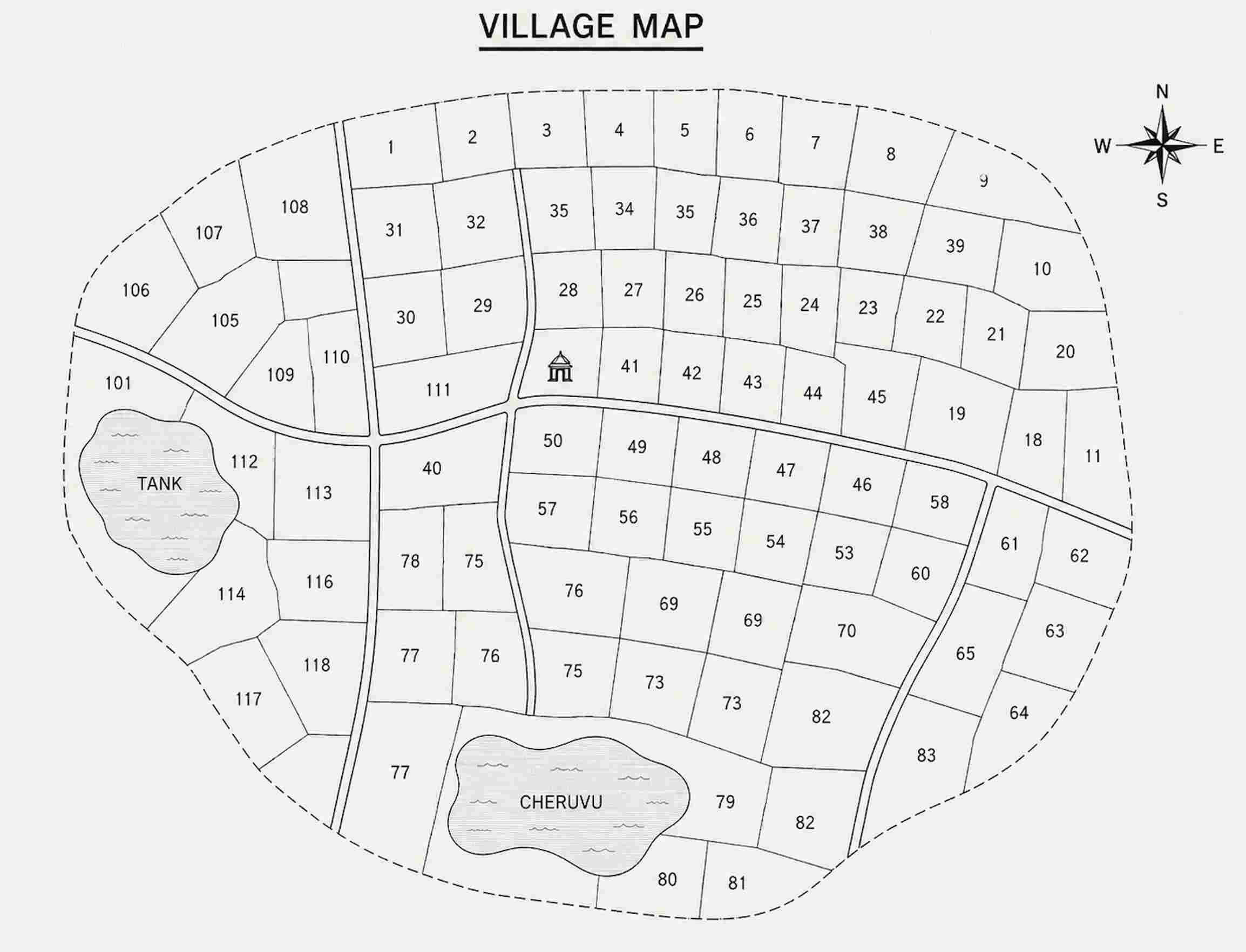
What is a Village Map in Telangana?
A Village Map provides an overview of land parcels within a village and displays important geographical information such as survey numbers, parcel boundaries, roads, water bodies, and neighbouring properties. Since these maps help users understand the location and layout of land parcels, they are widely used for property verification and land-related decision-making.
Uses of Village Map
The Village Map Revenue Service can be useful in several property-related situations:
- Verify Land Boundaries Before Purchase – Understand the location and boundaries of land parcels before buying property.
- Identify Survey Number Locations – Locate specific survey numbers within a village.
- Validate Land Parcel Positions – Verify the position of a property in relation to surrounding land parcels.
- Check Road and Access Connectivity – Review nearby roads and access routes connected to the property.
- Verify Neighbouring Survey Numbers – Understand adjacent survey numbers and surrounding land parcels.
- Support Property Verification – Use official map records during property due diligence and verification.
How to download Village Map Through mypatta?
You can quickly request Village Map through mypatta.
Steps to download Village Map Online from mypatta:
- Open mypatta and log in or sign up if needed.
- Select Telangana as the state.
- Choose Village Map in Revenue Service.
- Submit your request to initiate record retrieval.
Once available, the Village Map will be shared for your reference, verification, and property-related requirements.
Frequently Asked Questions (FAQs)
- 1.Can I use a Village Map during property purchase?+
Yes, buyers often use it to verify land location and surrounding survey numbers
- 2.Is Village Map useful for land development projects?+
Yes, developers use it to understand access roads, surrounding parcels, and village layouts.
- 3.How does a Village Map help in land due diligence?+
It helps verify the property's location and ensures that the survey number exists within the village records
- 4.Why do banks sometimes ask for land maps?+
Banks may review maps to verify the location and identity of land offered as collateral.
- 5.Can a Village Map help identify government land nearby?+
Yes. It may indicate public roads, water bodies, and other government-controlled areas adjacent to the property.
Conclusion
Village Map in Telangana helps property owners, buyers, surveyors, and legal professionals access official village maps containing important land and geographical information. Whether you need to verify land boundaries, locate survey numbers, check road connectivity, or understand the layout of a village, Village Maps provide valuable insights for property verification and planning. Through mypatta, you can conveniently request and access Village Maps online, making land record verification and location analysis simpler and more efficient.