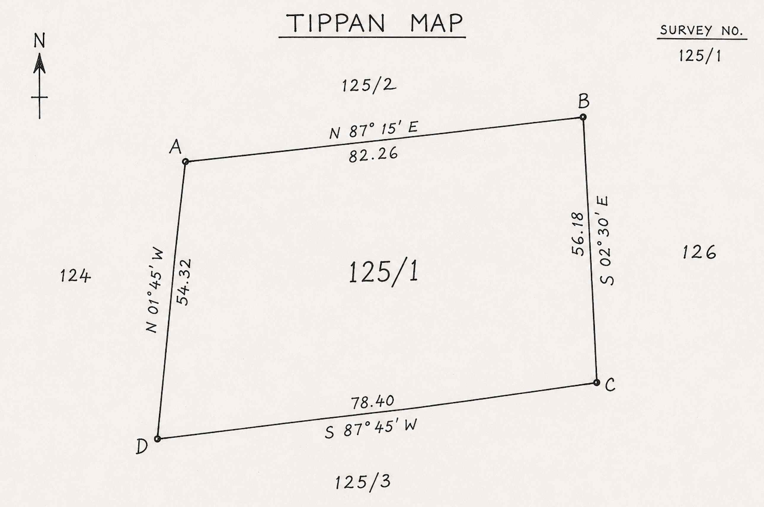
What is Tippan Map in Telangana?
The Tippan Map helps property owners, buyers, surveyors, advocates, and landowners access official survey sketches maintained by the Revenue and Survey Department.
A Tippan Map (also known as Tippani Map or Field Measurement Sketch) contains important information such as the exact shape of the land parcel, boundary lengths, dimensions, subdivision details, and adjoining survey numbers. Since these records serve as an authoritative reference for land measurements and survey boundaries, they are widely used for property verification and ownership-related matters.
Uses of Tippan Map
The Tippan Map Revenue Service can be useful in several property-related situations:
- Verify Exact Land Measurements – Confirm the official dimensions and extent of a land parcel.
- Resolve Boundary Disputes – Compare survey records to determine accurate property boundaries.
- Identify Land Subdivisions – Verify subdivision layouts and survey subdivisions.
- Compare Field Boundaries on Ground – Match actual land boundaries with official survey records.
- Assist Legal Property Verification – Support title verification and property due diligence.
- Review Historical Survey Layouts – Examine historical survey sketches and land configurations.
How to get Tippan Map Through mypatta?
You can quickly request Tippan Map records through mypatta.
Steps to download Tippan Map Online :
- Open mypatta and log in or sign up if needed.
- Select Telangana as the state.
- Choose Tippan Map in Revenue Service.
- Submit your request to initiate record retrieval.
Once available, the Tippan Map will be shared for your reference, verification, and property-related requirements
- 1.Can a Tippan Map help identify encroachments on my land?+
Yes. By comparing the official survey sketch with the actual site, potential encroachments can often be identified.
- 2.Why do surveyors refer to Tippan Maps during land measurement?+
The map contains official survey dimensions and boundary details used for accurate field verification.
- 3.Can I verify the exact shape of my plot using a Tippan Map?+
Yes. Tippan Maps show the physical shape and layout of the survey parcel.
- 4. Can Tippan Maps help resolve boundary disputes with neighbors?+
Yes. They are commonly used to verify official boundary dimensions during disputes.
- 5.What if my site measurements differ from the Tippan Map?+
A difference may indicate survey errors, encroachments, or historical changes requiring further verification.
- 6.Can I check land subdivisions using a Tippan Map?+
Yes. It often shows survey subdivisions and their individual boundaries.
Conclusion
Tippan Map in Telangana helps property owners, buyers, surveyors, and legal professionals access official survey sketches containing important land measurement and boundary information. Whether you need to verify land dimensions, resolve boundary disputes, identify subdivisions, or support legal property verification, a Tippan Map provides valuable survey-level details about a property. Through mypatta, you can conveniently request and download Tippan Maps online, making land verification and survey record retrieval simpler and more efficient