Muralidhar


Got the requested documents on time. Thanks

Get a digitally signed West Bengal plot map online by Plot (Dag) Number.
Enter details

Your money is safe with us - guaranteed delivery or a 100% amount refund
Why mypatta?


 App rating
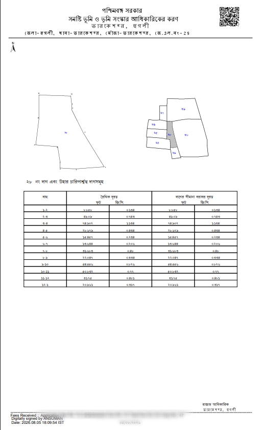
Certified Plot Map is a digitally signed plot map record maintained by the Revenue Department, Government of West Bengal. It shows the shape and boundary of a specific Dag (plot) along with its surrounding Dags within the Mouza, plotted to scale with a north marker. Each map includes a boundary-distance table listing the linear distance and distance along the Dag boundary for every segment. Users can request the map through District, Block, Mouza, and Dag (Plot) Number. These records are useful for boundary verification, property due diligence, and land record reference before transactions.

It is a digitally signed cadastral map from Banglarbhumi that shows a specific Dag (plot) and its surrounding Dags within the Mouza, along with a boundary-distance table for that plot.

100+ Certified Plot Map successfully delivered across West Bengal

Digitally Signed
Got the requested documents on time. Thanks
Great app, very speed and smooth response from customer support. Got documents within 30 minutes.
Thank you to mypatta team my problem is solved and guided me. I am happy to say this.
Excellent customer service. Very nice. They listened patiently and gave a clear solution. Happy with support.
Related Documents / Services
Related Blogs


