Muralidhar


Got the requested documents on time. Thanks
View village map online to understand survey numbers, land layout, boundaries, and nearby features clearly
Enter details
Your money is safe with us - guaranteed delivery or a 100% amount refund.
Why mypatta?
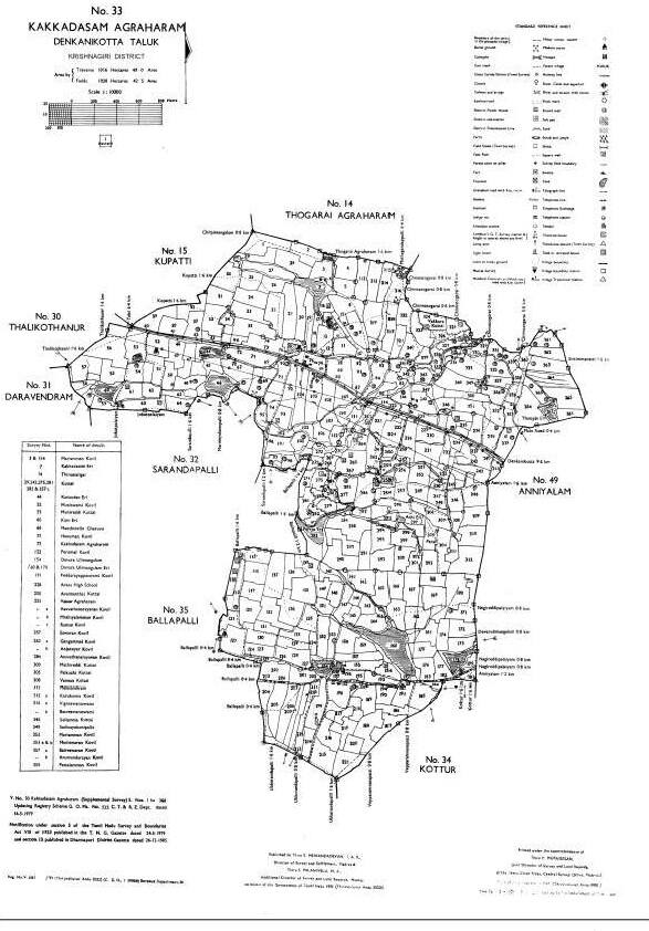
A Village Map (கிராம வரைபடம்) in Tamil Nadu is an official land record map that shows the complete layout of a village, including land parcels, survey numbers (சர்வே எண்), roads, water bodies, and boundaries. It helps identify the exact location and extent of land within a village. Users can view the village map online (ஆன்லைன் கிராம வரைபடம் பார்க்க) in Tamil Nadu or download village map records through mypatta, which integrates data from official government land record systems. Village maps are widely used for verifying land details, understanding survey layouts, avoiding disputes, and supporting land development or agricultural planning.
A Village Map shows the overall layout of a village, including roads, boundaries, and survey numbers, while an FMB Sketch provides detailed measurements and boundaries of individual land parcels.
500+ Village Map successfully delivered across Tamil Nadu
Information Copy — for reference purposes only
Got the requested documents on time. Thanks
Great app, very speed and smooth response from customer support. Got documents within 30 minutes.
Thank you to mypatta team my problem is solved and guided me. I am happy to say this.
Excellent customer service. Very nice. They listened patiently and gave a clear solution. Happy with support.
Related Documents / Services
Related Blogs