Muralidhar


Got the requested documents on time. Thanks

Download Goa Bhunaksha to locate and verify your land parcel's boundaries, location, and surrounding land parcels.
Enter details
Your money is safe with us - guaranteed delivery or a 100% amount refund
Why mypatta?


 App rating
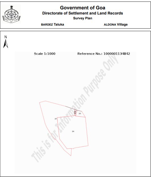
The Goa Bhunaksha (जमीन नकाशा) provides a visual representation of a specific land parcel using its property identifiers, supporting both Rural and Urban search flows. Rural properties are identified using District, Taluka, Village, Survey Number, and Subdivision Number, while Urban properties are identified using City, Sub City, PT Sheet, and Chalta Number.A Land Map can be useful when you want to visually verify a single land parcel and its surrounding layout, rather than a village-wide view. It can help you review parcel boundaries and location details while researching or verifying a property.

A Goa Bhunaksha is a map-based property record that provides a visual representation of a selected land parcel or property. It can help users understand the location and layout of the property.

100+ Bhunaksha successfully delivered across Goa

Information Copy — for reference purposes only
Got the requested documents on time. Thanks
Great app, very speed and smooth response from customer support. Got documents within 30 minutes.
Thank you to mypatta team my problem is solved and guided me. I am happy to say this.
Excellent customer service. Very nice. They listened patiently and gave a clear solution. Happy with support.
Related Documents / Services
Related Blogs






