What is HMDA Land Use Map?
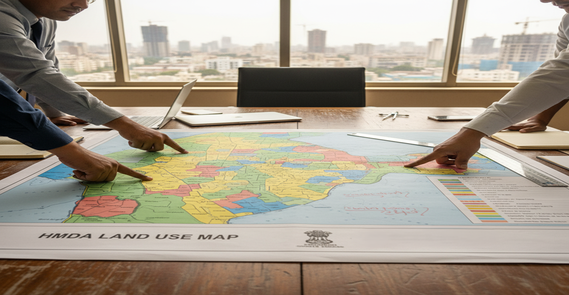
The HMDA Land Use Map is an official zoning map created by the Hyderabad Metropolitan Development Authority (HMDA) to show how each land parcel is classified in the Hyderabad metropolitan area. This classification is based on the Hyderabad Master Plan 2031 and helps regulate urban growth across Telangana.
It identifies zones such as:
- Residential Zone
- Commercial Zone
- Industrial Zone
- Recreational/Green Zone
- Prohibited/Restricted Zone
Key Components of HMDA Land Use Map Telangana:
- Survey Number: Unique identifier for every land parcel
- Zoning Type: Residential, Commercial, Industrial, etc.
- Locality: Village, Mandal, Municipality, District
- Master Plan Layer: Zoning boundaries from HMDA’s official master plan
- These details help landowners, buyers, and developers ensure that the land complies with HMDA zoning map rules before beginning any construction or applying for layout approvals.
How to Download HMDA Land Use Map Online
You can quickly check your HDMA Land Use Map using mypatta . It’s easy to use and works best even on your mobile phone.
Steps to download HMDA Land Use Map from mypatta:
- Open mypatta and log in or sign up if needed.
- Go to property documents, ensure “Telangana” is selected as the state, then tap the “HMDA Land Use Map ” icon.
- Enter the required information
- Tap “Get Map”
- Once HMDA Land Use Map is available to download, tap “View Document”.You can Download/Share/Save Map as PDF – fast and hassle-free.
Why is HMDA Land Use Classification Important?
Verifying land use classification helps you:
- Avoid building in restricted or illegal zones
- Ensure land is suitable for your purpose (home, shop, factory)
- Speed up layout and building plan approvals
- Comply with HMDA development regulations
- Prevent penalties, demolition, or legal disputes
Use Cases of HMDA Land Use Map
- Verify Land Zoning in Hyderabad
Helps users confirm whether a plot is zoned as Residential, Commercial, Industrial, Agricultural, or Recreational under the HMDA Master Plan. - Apply for Construction or Layout Permissions
Required to obtain HMDA building approval, layout approval, or for change of land use (CLU) requests. - Ensure Legal Land Use Compliance
Prevents illegal construction by ensuring your land use matches what is allowed as per the Hyderabad zoning regulations. - Avoid Unauthorized or Unapproved Layouts
Protects land buyers from investing in layouts that are not approved by HMDA or fall under restricted zones like green belts. - Urban Infrastructure Planning Tool
Used by government departments to plan roads, sewage, water supply, and electricity networks in expanding city areas. - Real Estate Project Feasibility Analysis
Developers use the HMDA Land Use Map to evaluate the potential of new residential, commercial, or mixed-use projects. - Support for Legal Disputes and Land Records
Can serve as official documentation in land disputes, property litigation, or for verifying land classification in Hyderabad. - Identify Buffer Zones and FTL Areas
Shows lakes, Full Tank Level (FTL) boundaries, green zones, and conservation areas to ensure environmental compliance. - Monitor Urban Expansion and Smart City Planning
Useful for urban planners to track Hyderabad’s growth trends and guide future city expansion under the HMDA jurisdiction. - Make Informed Property Investment Decisions
Helps investors understand zoning impact on property value, especially in high-growth HMDA zones like IT corridors and commercial hubs.
Difference Between HMDA Land Use Map and Encumbrance Certificate(EC)
The HMDA Land Use Map shows how land in Hyderabad is zoned—like Residential, Commercial, Industrial, or Green Zone—as per the HMDA Master Plan. It helps check whether you can legally build or use the land for a specific purpose. On the other hand, an Encumbrance Certificate (EC) is a legal document from the Sub-Registrar Office that shows the ownership history and transactions (like sale or loan) on the property.
In short:
- Use the HMDA Land Use Map to check land classification in Hyderabad.
- Use the Encumbrance Certificate to check if the land is legally clear and has no dues or claims.
Frequently Asked Questions (FAQs)
1. Is HMDA approval mandatory for building a house in Hyderabad?
If your land falls under HMDA limits, you must get HMDA approval for building plans to avoid legal issues and ensure compliance with zoning rules.
2. Can I build in a green zone under HMDA?
No. Construction in green/recreational zones or buffer areas is typically prohibited and may result in demolition or fines.
3. How do I convert land use in HMDA?
Apply for land use conversion through HMDA with supporting documents and justification. Approval is mandatory before any construction.
4.How often does HMDA update its Land Use Master Plan?
HMDA updates the Master Plan periodically to accommodate urban expansion and development needs.
5. Can commercial activity be done in residential zones under HMDA?
Only limited or mixed-use commercial activities are allowed in residential zones. For full commercial usage, your plot must be zoned as commercial in HMDA map.
Key Takeaway
- The HMDA Land Use Map in Telangana helps you check land classification and its approved purpose.
- It is essential before buying or developing land in Hyderabad and surrounding HMDA limits.
- Verifying HMDA land classification helps you avoid costly mistakes and legal issues.
- Always check the map before you invest, construct, or apply for approvals.
Other Blog links
1.https://mypatta.in/blog/encumbrance-certificate-ec-telangana-how-to-get-it-online-its-purpose-faqs/
5.https://mypatta.in/blog/certified-ec-telangana-how-to-apply-online-its-purpose-and-faqs/
6.https://mypatta.in/blog/pattadar-passbook-in-telangana-how-to-download-its-uses-faqs/
7.https://mypatta.in/blog/ror-1b-in-telangana-how-to-download-it-online-its-purpose-faqs/


