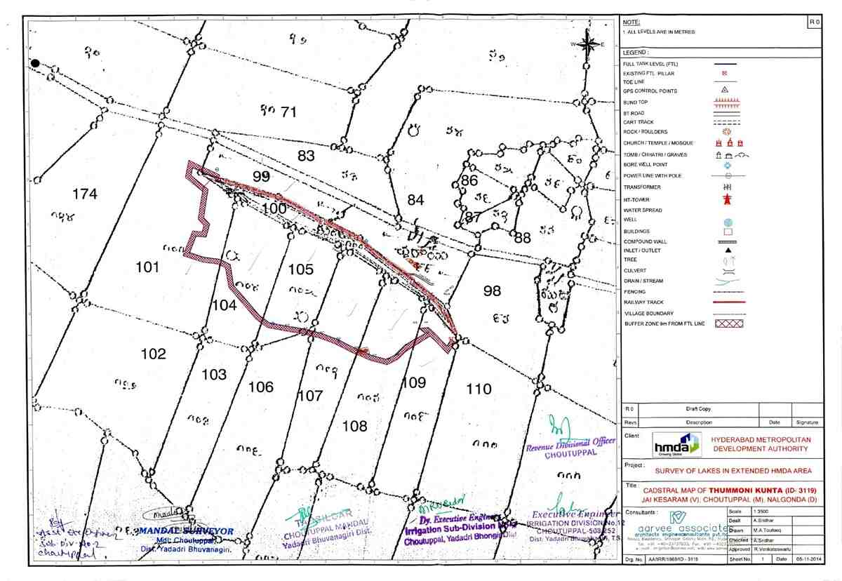
The Hydra Cadastral Map provides survey number-wise land details around lakes and water bodies. It helps in identifying ownership, legal status, and proximity to FTL zones, ensuring proper land management and regulation.
Happy customers
Docs downloaded
Safe & secure
Many users opted for expert consultation while ordering Certified Copy/Nakal
What is HYDRA?
HYDRA (Hyderabad Disaster Response and Asset Protection Agency) manages public assets, prevents encroachments, and handles disaster risks in Hyderabad.
What is the difference between Hydra FTL Map and Hydra Cadastral Map?
The FTL Map shows the water spread area in detail, while the Cadastral Map shows survey boundaries along with FTL.
Can I purchase land shown in the Cadastral Map?
Yes, but you must verify if the land is outside the FTL boundary before buying.
What documents should I check before buying land near a lake?
Always verify the Hydra FTL Map, Hydra Cadastral Map, and government land records to avoid legal issues.
What is the meaning of preliminary notification and final notification in hydra maps?
Preliminary notification is a draft announcement marking land under FTL or buffer zones, allowing public objections or corrections. Final notification confirms these boundaries after review, making them legally binding and restricting new constructions in those zones.