Chandrasekhar
Very useful app. Easy to use and it made my life easy. Very good customer support.
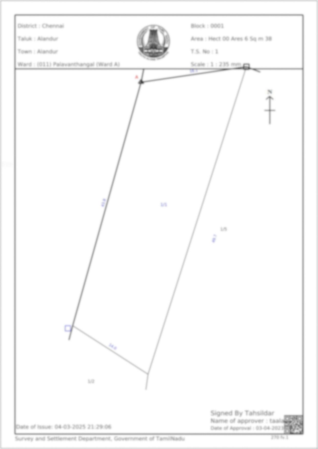
The Town Survey Land Records (TSLR) Sketch is an official map issued by the Tamil Nadu government that depicts the boundaries, survey numbers, and classifications of urban land parcels. It is crucial for verifying land extent, ownership, and legal compliance.
5 Lakh+
Happy customers
80 Lakh+
Docs downloaded
100%
Safe & secure
15000+
User Consultations
How is the TSLR Sketch different from a FMB Sketch?
TSLR Sketches are used for urban lands, while FMB Sketches are for rural properties.
Is a TSLR Sketch mandatory for property registration?
While not always mandatory, it is highly recommended for verifying land details before transactions.
Can I use a TSLR Sketch for building approvals?
Yes, municipal authorities may require it for approving construction plans.
What is the validity of a TSLR Sketch?
A TSLR Sketch remains valid unless there are changes in land boundaries due to subdivision, sale, or government acquisition.
Can a TSLR Sketch be used as proof of ownership?
No, while it helps verify land details, ownership proof requires a registered sale deed and Patta which you can get on your mypatta app.
Very useful app. Easy to use and it made my life easy. Very good customer support.
Good Experience after using this app. Very useful and time saving process.
Good helpful information about agriculture lands.
Phenomenal!! I got my required documents in one day.