Asiya
Thank you to mypatta team, my problem is solved and guided me I am happy to say this.
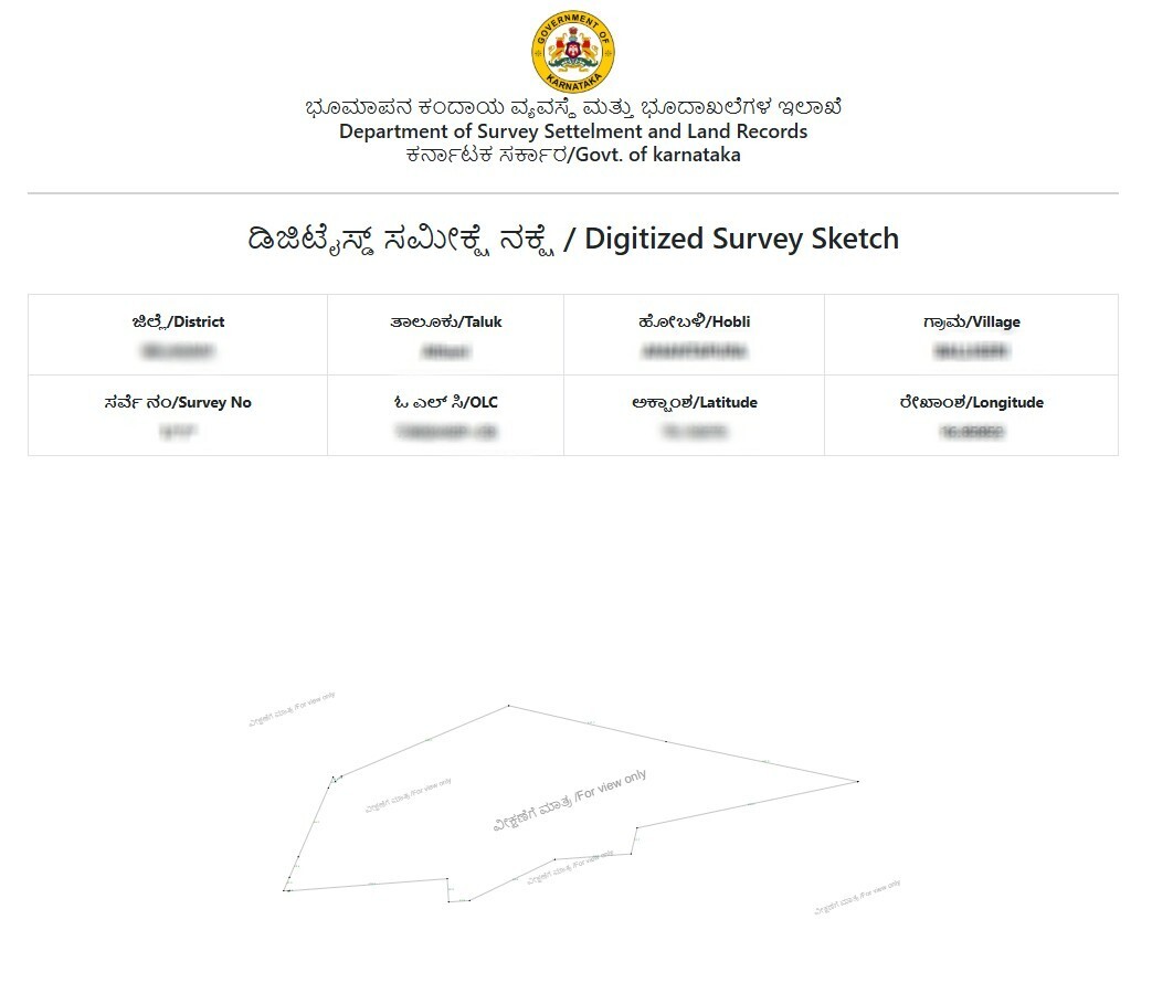
The Survey Sketch is an official document issued by the Karnataka Survey Settlement and Land Records Department that clearly defines the legal boundaries of a land parcel using its survey number. It shows the land’s shape and borders based on field surveys.
5 Lakh+
Happy customers
80 Lakh+
Docs downloaded
100%
Safe & secure
15000+
User Consultations
How is Survey Sketch different from RTC or Pahani?
RTC (or Pahani) shows land ownership and usage, while Survey Sketch shows the exact boundary lines and shape of the land.
Is this document helpful for bank loan or property mortgage?
Yes, Banks may ask for boundary confirmation to validate property extent.
Will the sketch mention road access or right of way?
No, the sketch only marks your land's official boundaries.
Will the survey sketch show built structures like houses or borewells?
No, it only shows plot boundaries, not internal constructions.
What should I do if my survey number is not found in the app?
Re-check the fields selected like village or survey number. If still not found, please contact us and we will help you.
Thank you to mypatta team, my problem is solved and guided me I am happy to say this.
Very nice and useful in our sitting place. Also the amount of fee is very low and cheap for the users.
I am truly pleased to gather these documents using the mypatta app, in a short period.
Great experience. Simple to use and quick response. Good job. Keep it up and keep adding more features.