Chandrasekhar
Very useful app. Easy to use and it made my life easy. Very good customer support.
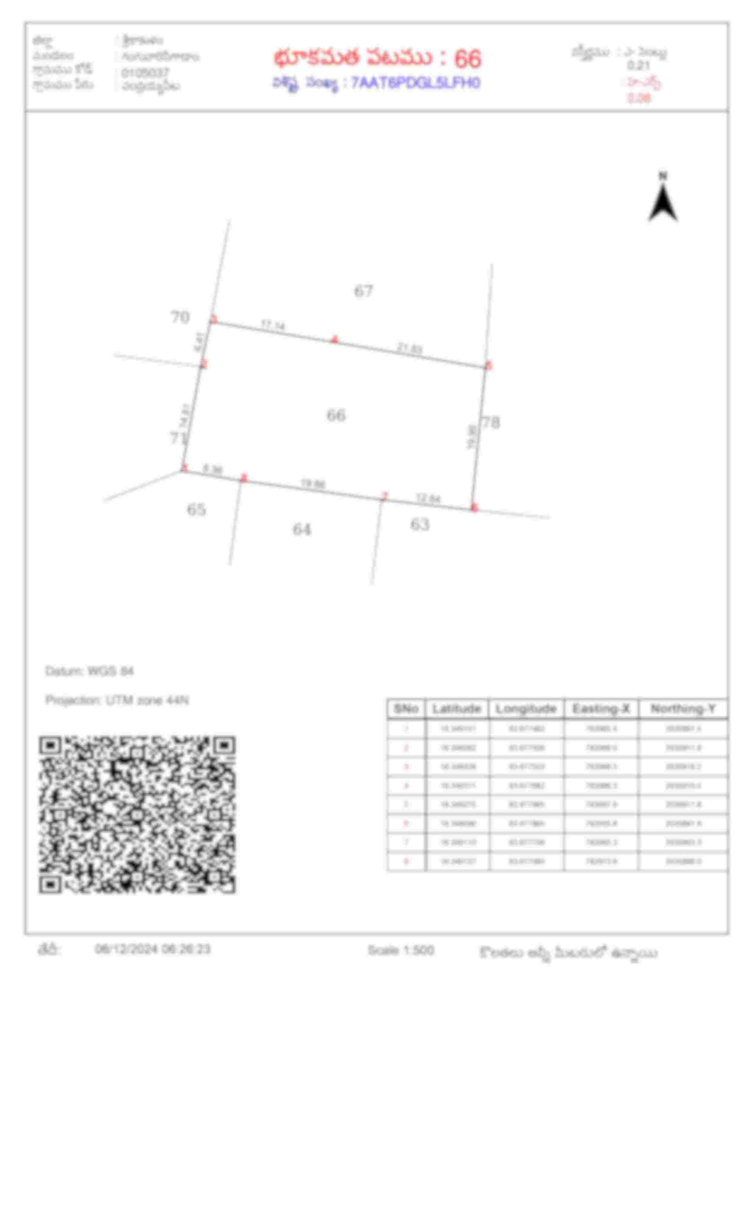
The Field Measurement Book (FMB), also known as the Land Parcel (LP) Map in Andhra Pradesh, is a vital document that provides detailed measurements and boundaries of land parcels. It plays a critical role in verifying the location, size, and dimensions of a property, making it indispensable for property transactions, land development, and resolving disputes.
5 Lakh+
Happy customers
80 Lakh+
Docs downloaded
100%
Safe & secure
15000+
User Consultations
Many users opted for expert consultation while ordering Certified Copy/Nakal
Can I get an FMB sketch for any property?
Yes, provided the property is surveyed and the records are available with the revenue department.
Is the FMB sketch proof of ownership?
No, the FMB sketch is only a boundary map. Ownership must be verified through documents like the Sale Deed or Title Deed or Certified Copy, which you can get from our 'Certified Copy' option in mypatta app.
What information is included in an FMB sketch in Andhra Pradesh?
An FMB or Land Parcel (LP) sketch provides a detailed representation of a survey number within a village. It can includes key details such as the survey number, village name, division number, mandal, district, extent of the land, khata number, boundaries, and the coordinates of vertices defining the land parcel.
What if my property doesn’t have an FMB sketch?
You can request a survey of your land from the Revenue Office to create an FMB sketch.
What should I do if there are errors in my FMB sketch?
Contact the Mandal Revenue Office and request a resurvey or correction with supporting documents.
What is the validity period of FMB sketch?
The FMB sketch does not have an expiry date. They are updated whenever there is a change in land measurements or boundaries due to subdivision or legal resolution.
Very useful app. Easy to use and it made my life easy. Very good customer support.
Good Experience after using this app. Very useful and time saving process.
Good helpful information about agriculture lands.
Phenomenal!! I got my required documents in one day.